Wind Shear Formula for Hub Height: Extrapolating Ground Data
Learn the power law wind shear formula to extrapolate 10m ground measurements to your turbine hub height. Includes coefficients, worked examples, and error ranges.
Share this article
windturbinehome.com/s/bfd2e4
The power law wind shear formula estimates wind speed at turbine hub height using ground-level measurements: V₂ = V₁ × (H₂/H₁)^α. Most small turbine sites use α = 0.143 (1/7 power law) for flat terrain, though values range from 0.10 for open water to 0.40 in dense forests. A 10 mph measurement at 10 meters extrapolates to 11.6 mph at 30 meters in typical suburban conditions (α = 0.20), yielding 56% more power—underscoring why accurate shear coefficients matter for residential viability calculations before spending $15,000–$45,000 on a system.
Understanding wind shear and vertical velocity gradients
Wind speed increases with height because surface friction—trees, buildings, terrain undulations—decays exponentially upward. The atmospheric boundary layer, typically 300–3,000 meters deep depending on time of day and weather stability, exhibits this velocity gradient most prominently in the lowest 100 meters where small turbines operate.
Two models dominate engineering practice: the logarithmic profile (preferred for meteorology, requires roughness length and zero-plane displacement) and the power law (simpler, adequate for turbine siting when empirical α values exist). Residential wind assessment defaults to power law because it requires only two measurements—reference height and hub height—without granular roughness data.
The power law equation:
V₂ = V₁ × (H₂/H₁)^α
Where:
- V₂ = wind speed at hub height (target)
- V₁ = measured wind speed at reference height
- H₂ = hub height (meters)
- H₁ = reference anemometer height (meters)
- α = power law exponent (dimensionless)
The exponent α encapsulates terrain roughness, atmospheric stability, and temperature inversion effects. Neutral stability daytime conditions produce textbook values; nighttime inversions can drop α near zero (wind speed barely changes with height) or even negative (speed decreases aloft), though these hours contribute little energy.
Selecting the appropriate shear coefficient
Standard practice begins with terrain classification. The IEC 61400-2 small wind turbine standard and NREL guidelines suggest baseline α values:
| Terrain type | α (power law exponent) | Description |
|---|---|---|
| Open water, tidal flats | 0.10 | Nearly frictionless surface |
| Short grass, airport runway | 0.14 (1/7) | Classic "rural open" assumption |
| Agricultural land, scattered trees | 0.16–0.18 | Most midwest farm sites |
| Suburban residential | 0.20–0.25 | Single-family homes, 30–40% coverage |
| Urban/industrial | 0.25–0.35 | Multi-story buildings, dense canopy |
| Forest, dense city center | 0.35–0.40 | Rarely suitable for small wind |
The 1/7 power law (α = 0.143) appears in older literature and remains common in utility-scale wind where sites are deliberately chosen for low roughness. Residential contexts demand site-specific measurement. A suburban property surrounded by mature oaks 50 feet from the proposed tower exhibits α closer to 0.28, while an exposed ridgetop ranch 400 meters from the nearest obstruction might see 0.16.
Measurement-derived coefficients trump lookup tables. Install a temporary 10-meter mast with cup anemometer and data logger for 6–12 months, capturing seasonal variation. Then raise a second sensor to intended hub height (or use a sonic anemometer profiler) for 4–8 weeks of concurrent logging. Calculate α from simultaneous readings:
α = ln(V₂/V₁) / ln(H₂/H₁)
This empirical approach accounts for local microtopography—that ravine channeling northwesterlies, the neighbor's barn creating a wake zone—that generalized tables miss.
Worked examples for common turbine configurations
Bergey Excel 10 at 24-meter hub height
Reference measurement: 8.2 mph average at 10 meters over 12 months, suburban site (α = 0.22).
V₂ = 8.2 × (24/10)^0.22
V₂ = 8.2 × 2.4^0.22
V₂ = 8.2 × 1.214
V₂ = 9.95 mph at 24 meters
Power scales with the cube of velocity. At 8.2 mph (3.67 m/s), air contains 31 W/m² swept area. At 9.95 mph (4.45 m/s), 55 W/m²—a 78% increase. Over the Excel 10's 7 m² rotor, that's 385 watts vs. 217 watts of available wind power, highlighting why 14 meters of tower height materially affects annual yield.
Primus Air 40 vertical-axis at 15-meter midpoint height
Reference measurement: 11.5 mph at 10 meters, open agricultural land (α = 0.16).
V₂ = 11.5 × (15/10)^0.16
V₂ = 11.5 × 1.5^0.16
V₂ = 11.5 × 1.068
V₂ = 12.3 mph at 15 meters
Vertical-axis turbines sweep from ground to twice hub height. For a 15-meter midpoint, the rotor spans roughly 5–25 meters. Wind speed varies across that range, so a mean-height calculation approximates reality. Averaging shear from 5m to 25m:
V₅ = 11.5 × (5/10)^0.16 = 10.7 mph
V₂₅ = 11.5 × (25/10)^0.16 = 13.1 mph
Effective average ≈ 11.9 mph
This 3% difference from midpoint-only calculation falls within measurement uncertainty for residential work.
Limitations and error sources in extrapolation
Power law accuracy degrades beyond 2:1 height ratios. Extrapolating 10-meter data to 80 meters introduces 10–15% error even with correct α because the logarithmic boundary layer structure reasserts itself at greater altitudes. Small wind turbines on 18–40 meter towers stay within the valid range; guyed lattice towers pushing 50 meters for 10 kW machines approach the limit.
Terrain discontinuities violate smooth-profile assumptions. A turbine 80 meters downwind of a barn experiences a wake that the power law—calibrated 400 meters upwind—cannot predict. The rule of thumb (tower height ≥ 10 meters above any obstruction within 150 meters) exists precisely because shear formulas break down in disturbed flow.
Atmospheric stability shifts α by ±0.05. Stable nighttime air (temperature inversion) suppresses vertical mixing, flattening the profile (lower α). Unstable daytime convection steepens it (higher α). Annual-average α smooths these fluctuations, but hour-by-hour extrapolation for HOMER or SAM modeling requires stability correction or accepts ±8% instantaneous error.
Instrument height uncertainty propagates exponentially. Mislabeling a 9.2-meter mast as 10 meters skews α by 0.03, yielding 4% hub-height error. Use surveyed heights; GPS elevation ±3 meters is insufficient.
Anemometer exposure asymmetry biases results. A sensor mounted southwest of a mast tube reads 2–5% low during prevailing northwest winds due to tower shadow. Calibrated sonic anemometers (±1% accuracy, $1,200–$2,800) outperform cup anemometers (±3–5%, $400–$800) for shear studies, though cups suffice for gross viability screening.
Integrating shear-corrected data into energy estimates
Wind resource assessment software—NREL's System Advisor Model, RETScreen, Windographer—expects Weibull distribution parameters (k shape, c scale) at hub height. Ground-level data must be height-corrected before fitting. The process:
- Bin concurrent measurements (10-minute averages standard).
- Calculate hourly α using the ln formula, filter for valid wind directions (exclude shadowed sectors).
- Apply median α to single-height dataset if only reference anemometer available long-term.
- Generate hub-height time series or adjust Weibull c parameter: c₂ = c₁ × (H₂/H₁)^α.
- Run turbine power curve against corrected distribution.
The 30% federal Residential Clean Energy Credit (IRC §25D, claimed on IRS Form 5695) applies to turnkey installed cost, making accurate yield forecasts financially material. A Bergey Excel 10 with tower installed for $38,000 generating 7,800 kWh/year at $0.14/kWh offers 10.5-year simple payback pre-incentive, 7.4 years after the $11,400 tax credit. Shear miscalculation inflating the forecast by 15% extends realized payback to 8.5 years, eroding homeowner satisfaction.
Regulatory compliance for hub height selection
Tower height triggers multiple jurisdictions. FAA Part 77 requires obstruction evaluation for structures exceeding 200 feet AGL near airports or 499 feet anywhere; residential turbines stay well below. State and local zoning often cap "accessory structures" at 35–65 feet, forcing variances for optimal hub heights.
NEC Article 705 interconnection standards don't specify tower height but indirectly influence it through required disconnect accessibility and service entrance sizing. A 10 kW Endurance turbine at 36 meters (118 feet) on guyed lattice needs grounding electrode system per NEC 250.52 and separately derived system treatment if isolation transformer used—consult a licensed electrician for site-specific compliance.
Property line setback rules frequently equal tower height plus 10 feet, consuming lot area. A 90-foot monopole requires 100-foot radius clearance (0.72 acres circular footprint), pushing hub height decisions toward compact suburban lots accepting 60-foot compromise towers despite 12% yield penalty.
DSIRE (Database of State Incentives for Renewables & Efficiency) lists state-level programs, many capping turbine size or height—Washington's small wind sales tax exemption covers systems under 100 kW but doesn't restrict height; California SGIP functionally excludes residential wind via minimum 10 kW and strict noise thresholds that force taller towers off-property.
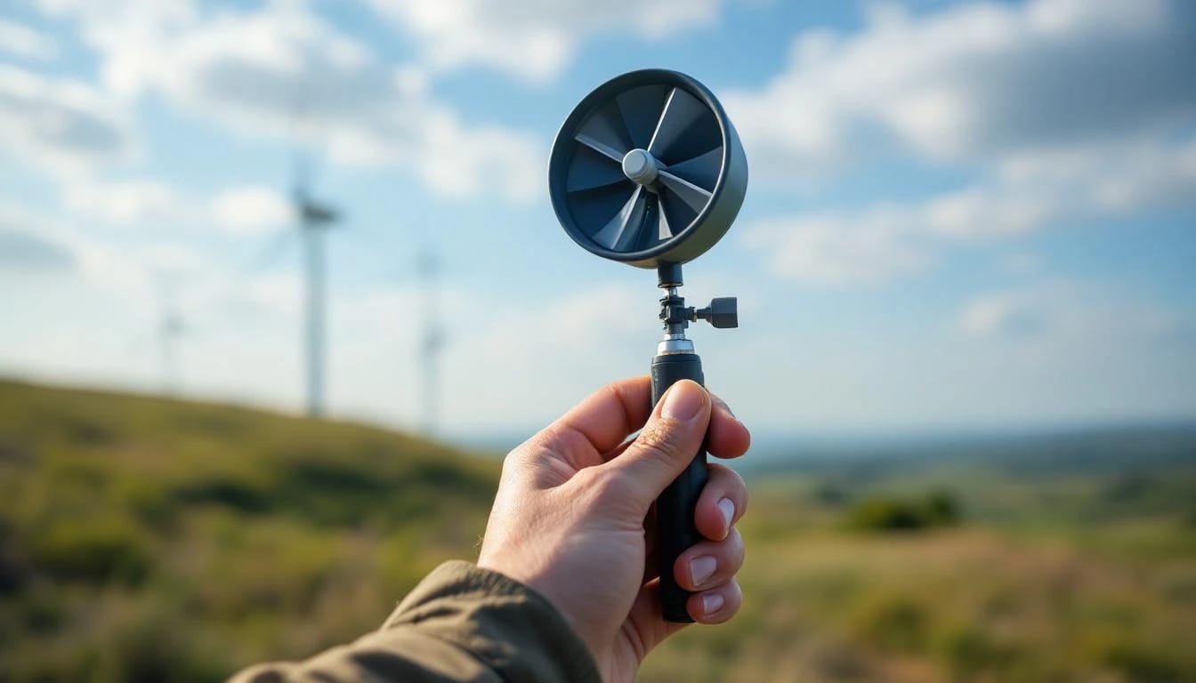
Field validation techniques for shear assumptions
Temporary met towers confirm α before capital commitment. A Telescoping Mast Solution 10-meter kit ($1,800–$2,400 with logger) measures V₁ for 12 months. Add a 4-week 20-meter mast rental ($600/month industrial scaffolding with platform) at the 9-month mark for concurrent V₂ logging. Calculate actual α, compare to table estimate, adjust hub height or site selection accordingly.
Sonic anemometer (SODAR) or light detection and ranging (LIDAR) profilers measure multiple heights simultaneously without towers. Units cost $25,000–$60,000 to purchase, but 2-week rental campaigns ($4,000–$7,000) capture enough data for residential shear characterization. The Primus F-15 project in Montana used SODAR to discover α = 0.31 in a valley the topographic map suggested would be 0.18, prompting a tower height increase from 18m to 27m.
Post-installation validation compares turbine production logs (modern inverters record 10-minute averages) against on-tower anemometer. A Bergey BWC Excel 10 producing 5% below model prediction despite wind sensor reading 10% above forecast indicates either power curve degradation (blade leading-edge erosion) or shear profile change (neighbor planted 40-foot spruce windbreak). Annual production reviews catch these long-term shifts.
Software tools and NREL resources for wind assessment
NREL's WindWatts project (mentioned in distributed wind research) develops improved resource assessment tools incorporating modern computational fluid dynamics, though the residential-facing portal remains under development as of early 2025. Current practitioner tools:
- Windographer ($895 perpetual license): Industry standard for met data cleaning, shear calculation, Weibull fitting, turbine energy estimates. Automates α calculation from multi-height sensors and flags data quality issues.
- HOMER Grid (free for systems <100 kW): Optimizes hybrid solar-wind-battery for net metering scenarios, imports shear-corrected wind files, models time-of-use rates common in California and Hawaii where wind complements afternoon solar.
- SAM (free NREL tool): More detailed electrical modeling, accepts hourly wind speed synthesis using Weibull + shear parameters, outputs NEC-compliant one-line diagrams for permitting.
NREL's Residential Energy Cost Estimator calculator provides coarse screening (select state, enter 10m wind speed, choose turbine model) but applies generic α = 0.20 nationwide. Useful for "is wind plausible here?" questions, inadequate for investment-grade assessment.
The AWS Truepower wind map layers (1 km resolution) underlying many free online tools derive from mesoscale modeling at 80–100 meter heights, then extrapolate downward assuming α = 0.143. Suburban sites experience 15–25% over-prediction; treat map values as upper bounds requiring on-site validation.
Advanced considerations for complex terrain
Ridgetop sites exhibit speed-up effects beyond shear. A turbine 50 meters horizontally from a ridgeline crest sees 20–40% higher winds than flat-terrain power law predicts due to flow compression. Computational fluid dynamics (CFD) modeling ($3,000–$8,000 service fee) or empirical correction factors (multiply power law result by 1.15–1.30 for convex slopes >10%) capture this. The Aeolos-H 10kW installation in Vermont's Green Mountains measured α = 0.11 despite surrounding forest (normally 0.35+) because ridge acceleration dominated.
Valley channeling creates anisotropic shear—α varies by wind direction. A gorge funneling northwest winds might show α = 0.08 from NW (high speed, low friction due to flow constriction) and α = 0.28 from south (slow, turbulent recirculation). Directional energy analysis in Windographer reveals whether to optimize for prevailing direction or compromise.
Forested sites demand clearance height, not hub height, as the reference. A 35-meter tower in 20-meter-tall timber places the rotor only 15 meters above the canopy—the effective roughness surface. Measure V₁ at treetop height (using a tall temporary mast or clearing a small monitoring gap) and apply α = 0.14–0.16 above the canopy rather than α = 0.35 from ground zero.
What happens if I use the wrong shear coefficient?
Using α = 0.143 (open terrain) when actual site conditions yield α = 0.25 (suburban) causes 8–12% energy forecast over-prediction for a 30-meter tower extrapolating from 10-meter data. A $32,000 turbine system projected to generate $1,400/year instead produces $1,230, extending payback by 1.2 years. Under-estimating α (using 0.20 when actual is 0.14) leaves performance margin but may justify inadequate tower height.
Can I extrapolate airport weather data to my property 15 miles away?
Airport ASOS/AWOS stations (typically 10-meter height) provide long-term averages useful for climate context but rarely represent specific residential microclimates. Terrain roughness, elevation differences, and local topography create 20–40% wind speed variation within a 15-mile radius. Use airport data to confirm regional wind regime (prevailing direction, seasonal pattern) but always measure on-site for viability decisions. The NREL Wind Toolkit (2007–2013 modeled data, 2 km resolution) offers better spatial granularity than point airports.
Does wind shear change throughout the day or year?
Yes—atmospheric stability varies diurnally and seasonally. Daytime solar heating creates unstable conditions (turbulent mixing, steeper velocity gradient, higher α), while nighttime radiative cooling stabilizes the boundary layer (suppressed mixing, flatter profile, lower α). Summer exhibits more daytime instability than winter. However, nighttime contributes less energy because winds often slacken. For annual production estimates, using a single averaged α (calculated from 6+ months of concurrent measurements) introduces <5% error. Hourly forecasting or battery dispatch optimization requires stability-corrected α(t) functions.
How much does turbulence affect shear extrapolation accuracy?
High turbulence intensity (TI > 18%) indicates flow disruption—wakes, terrain separation, thermal convection—that violates the smooth power-law profile assumption. Turbulence reduces turbine capacity factor by 5–15% independent of mean wind speed because rotors shed load during gusts and stall during lulls, extracting less energy than steady flow at the same average velocity. Shear formulas remain mathematically valid but turbine power curves degrade. Sites with measured TI exceeding 20% warrant CFD modeling or accepting manufacturers' "high-turbulence" power curves (lower output) rather than standard curves.
Is LIDAR or SODAR necessary for small residential wind sites?
Not necessary but valuable for properties representing $30,000+ investment. A $1,500 met tower campaign over 12 months establishes V₁ adequately; adding $5,000 short-term LIDAR to measure α empirically reduces uncertainty from ±15% (table lookup) to ±5% (measured). The break-even calculation: if improved confidence prevents one unprofitable installation or justifies a $6,000 taller tower yielding $400/year additional production, the LIDAR pays for itself. Developers installing multiple turbines amortize remote sensing over several sites; individual homeowners rely on met towers unless marginal wind resources (class 2) demand precision.
Bottom line
Accurate wind shear extrapolation using the power law formula V₂ = V₁ × (H₂/H₁)^α transforms ground measurements into hub-height reality, directly affecting ROI projections for residential turbines. Select α from measured concurrent data when possible or terrain-appropriate tables (0.16–0.18 rural, 0.20–0.25 suburban), accept 8–12% uncertainty from lookup values, and validate assumptions with on-tower monitoring post-installation. Calculate expected hub-height wind speed before committing to tower height and turbine model—2 mph difference at rotor level translates to 73% more available power and determines whether that Bergey Excel or Primus Air delivers positive cash flow or becomes an expensive lawn ornament.
Share this article
windturbinehome.com/s/bfd2e4
Editorial note: This article was researched and written by a member of the Wind Turbine Home editorial team. AI-assisted tools were used for spell-checking and light grammar review only — all research, analysis, and conclusions are our own. Our editorial policy prohibits sponsored content and paid placements. Read our editorial policy →
Related reading
wind resource assessment
Weibull Distribution for Wind Energy: What k and c Actually Mean
Learn how Weibull k (shape) and c (scale) parameters define your site's wind profile and predict small turbine output. Real examples from 5-10 kW installations included.
wind resource assessment
Wind Turbine Swept Area: Calculate Rotor Size & Power Output
Swept area determines how much wind energy a turbine can capture. Learn the formula, why rotor diameter matters more than blade count, and how to size a system.

wind resource assessment
How To Read the DOE WindExchange Map for Your Address (2025)
The DOE WindExchange map shows wind speed at your home—but only if you decode hub height, filter layers, and match your turbine class. Here's the exact process.
wind resource assessment
How to Measure Wind Speed at Your Property Before You Buy
Learn proven methods to assess wind resources on your property using anemometers, data loggers, and free tools—so you know if a turbine investment makes sense.

wind resource assessment
Do Wind Turbines Work in Low Wind Areas? Performance Analysis
Small wind turbines need minimum 9-10 mph average wind to generate meaningful power. Low-wind sites under 8 mph often produce 30-40% of rated output, making payback periods exceed 25 years.
wind resource assessment
How Much Wind Do You Need for a Home Wind Turbine?
Home wind turbines need average wind speeds of 10+ mph (Class 2) to generate meaningful power. Most residential sites require 9-12 mph sustained winds to justify investment.